Marketing Logic has implemented a new tool "Availability Zones" in the GIS Atlas
2 March, 2021
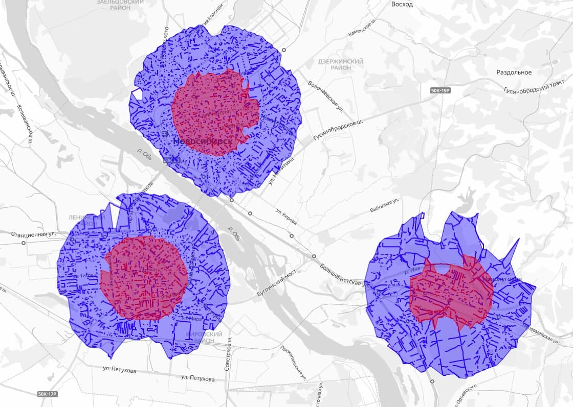
The Atlas geoinformation system has expanded its functionality with a new tool called "Availability Zones". It allows to accurately delineate an area accessible to a pedestrian or motorist at a given distance according to road graphs. Unlike the existing radii in the system, which display various parameters and variables in a given area (for example, the number of residents, infrastructure facilities, or calculated project data), the "Accessibility Zone" tool displays only those parts of the territory that a pedestrian can reach without exceeding the specified distance.
The tool takes into account natural obstacles: rivers, lakes, mountains, and other obstacles. The geo-availability factor is critical when calculating the potential traffic of a retail outlet or other infrastructure object. The audience coverage around the object is important, and the tool "Accessibility Zones" clarifies this data, shows which of the residents in the selected radius will be really convenient to get to the selected point.
«We implemented this tool because it became critical for one of our major projects. Now we understand that it can be used much more widely: wherever updated geo-availability data is needed. If you set a radius of one kilometer in the menu, the system will build a polygon immediately taking into account the roads, the entire length of which will not exceed thousands of meters for your path. If there is a river in front of you after 500 meters and there is no bridge, the entire territory behind it will logically not fall into this accessibility zone. For many tasks, this factor will allow you to more accurately determine the customer base, real and expected traffic. We are pleased to introduce this Atlas GIS tool to our customers and the market as a whole», says Dmitry Galkin, Managing Partner of Marketing Logic.
The "Availability Zones" tool takes into account the principles of Dijkstra's algorithm and uses information from Marketing Logic's own data showcase and Open Street Map data. For customized projects, calculations can also be enriched with client data in the case of integration of GIS Atlas with CRM or Data Governance systems of the customer.